After an extemporaneous visit to the "new" Celtic Cross monument at Port Weymss (commemorating the sacrifice of local men during World War Two), we headed into the heart of Islay's Rinns for a day of exploration. Once more, our exploring took us off Islay's main road network. We took the north-south single track from Portnahaven to Kilkiaran Bay.
 |
| March 23, 2017 Portnahaven single track; south of Kilkiaran Bay |
The name for this "minor" road is not known. For our purposes, the "Kilkiaran Road" will have to work. Other than the A847 on the east shore of the Rinns along Loch Indaal, the single track "Kilkiaran Road" from Portnahaven is the only vehicular route on the Rinns. Skirting Islay's western seaboard, it runs parallel to the main A847 road from Port Charlotte to Portnahaven.
 |
| March 23, 2017 Kilkiaran Bay one of the few natural ports on west Rinns |
The northbound Portnahaven single track turns east at Kilkiaran Bay. At this point, the single track is apparently called "Schoolhouse Road". It runs to Port Charlotte where it links up with the main A847. The west side Portnahaven-Kilkiaran single track when combined with the A847 provides a less traveled and scenic loop route on the southern half of the Rinns for those tourists interested in such explorations that lie beyond the scotch distilleries of Islay.
 |
| March 23, 2017 Port Charlotte |
In its construction, local ambition wanted to punch the single track through the Rinns all the way to Kilchoman, and thus provide an uninterrupted link along the island's west side, a continuous north-south direct single track from Portnahaven to the Kilchoman Parish Church. But the through route was not be.
The single track was not completed north of Kilkiaran Bay due to difficult terrain in the Rinns, a shortfall of money and other competing priorities which intervened. Here the Scriptural metaphor recalls the parable from Luke 14:28-29 regarding unfinished constructions.
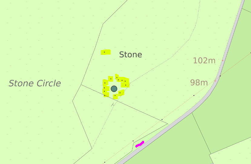
That metaphor is also appropriate for a site that we had earmarked on our 2017 Islay itinerary as a "must see"--the Cultoon "stone circle". Cultoon lies on the unfinished "Kilkiaran Road". The stone circle too had been started, in its case untold ages ago. And it too was never completed.
 |
| Advise using Car Park since high tensile fence lacks direct access at gate to Cultoon circle |
 |
| March 23, 2017 Wide lens view of the unfinished Cultoon Stone Circle |
Work on the Cultoon stone circle has been arrested in time. Differing by degrees, perhaps, but Islay's peat which covered the Cultoon circle was similar in its preservation as was the more infamous volcanic ash that covered Pompeii (Mount Vesuvius eruption in 79 A.D.).
While many archeological sites in west Scotland have not been excavated, Cultoon's stone circle was formally investigated in the mid-1970s by Euan MacKie. Because the site was essentially peat covered, MacKie considered the Cultoon excavation as a "blind test" of Scottish engineer Alexander Thom's hypothesized "Megalithic yard" in use during Stone Age construction.
 |
| March 23, 2017 One of two visible standing stones (~east) at Cultoon Stone Circle |
 |
| March 23, 2017 Cultoon's second visible standing stone (~west); rock cairn bank (foreground) |
To the degree possible these many thousands of years later, Cultoon's story is now partially known. This is not to say that significant scholastic disagreement does not exist.
The original plan at Cultoon apparently was an ellipse with 15 standing stones. Three standing stones were actually erected, two of which two are visible and upright. One was a broken stump of a standing stone, revealed only by the excavation work...after removing the peat layer above it.
 |
| March 23, 2017 High tensile fence right on the edge of Cultoon circle |
Twelve stones of considerable size were apparently intended to be raised as standing stones in the circle. But these remained prone on the old ground surface, after having been dragged to the Cultoon site many thousands of years ago. These megaliths were more or less positioned on the former solid ground surface into a rough ellipse, apparently in preparation for their installation into socket pits in an ellipse of standing stones.
 |
| March 23, 2017 Prone megaliths at Cultoon, with one of two standing stones (~west) visible |
Socket pits had indeed been dug into the old ground surface...for some of the planned standing stones. Five sockets with corresponding stones remained empty, never receiving their standing stone. And even the socket hole digging part of the project was incomplete. Some stones apparently never had sockets dug at all. And the dragging of megaliths to the site was also unfinished, since some socket holes (nine total) were dug but which lacked a corresponding stone.
For unknown reasons, the Cultoon stone circle was abandoned, right in the middle of its construction.
 |
| March 23, 2017 Cultoon stone circle terrain |
Over time, the abandoned open socket pits silted over. One open socket, however, was deliberately filled, apparently at the time Cultoon was abandoned.
Megaliths intended for standing stones in the planned Cultoon circle were simply left where they laid on the old ground surface...and this is key. The archeological time boundary is the old original surface, directly underneath the stones that had been dragged to the Cultoon site.
The peat which today covers much of the Hebrides has not always been there. In fact, at the time the Cultoon circle was being constructed, the ground was solid with a soil profile. The large megaliths therefore lay in direct contact with that older ground surface. Then, in time, the old ground surface and the prostrate megaliths were subsequently covered (or partially covered) by a meter or deeper layer of peat, in situ.
During the formal excavation at Cultoon, Carbon 14 dating indicated that peat did not begin to cover the site until after approximately 765 B.C., roughly concurrent with the transition period between the Bronze Age and the Iron Age. Thus, the Cultoon stone circle had to date at least some considerable time before this cultural boundary. Besides, megalithic constructions of standing stones and circles had more or less culturally ceased by the close of the Bronze Age [c. 2100 B.C. to 750 B.C] throughout Scotland, as the interests of human society changed.
 |
| March 23, 2017 Two prone megaliths at Cultoon circle (#3 in MacKie's site plan) |
Just north of the circle (considered part of the Cultoon site, though scholastic debate continues) is a single standing stone on a small hill. Its stone socket had also been dug into the old surface before the peat encroached. Prehistoric fires apparently had been set a number of times on the hill's old surface prior to peat encroachment. A dense large mass of charcoal from these fires was Carbon 14 dated to the late Bronze Age, an un-calibrated date of approximately 1055 B.C. Calibrated, the date of these fires was estimated to be (c. 1600 B.C. to 800 B.C.)
 |
| Site map of Cultoon from excavation by MacKie |
This indicates that the Cultoon site was revered (or at least in use) since Mesolithic times [c. 10,000 to 5,000 B.C.--the era during which rising seas separated Britain from Europe, and Ireland from Britain.] Mesolithic flints are indeed known on the Rinns side of Islay, unearthed from excavations at nearby Coulererach, just north of Kilchoman. Carbon 14 dating of charcoal from the Coulererach "occupation level" dates approximately to 5,500 B.C.
Also discovered on Cultoon's old surface and just above it, archeologists found larger flints, which they assumed were Neolithic in age [c. 4,000 to 2,000 B.C.] Based on this sequence profile of artifacts, at least in my own novice opinion, the unfinished Cultoon stone circle is probably not later than early Neolithic, given these intermixed stone artifacts. This suggests that the Cultoon construction project was undertaken during the approximate cultural transition between Mesolithic and Neolithic, with the understanding that early cultural ages often overlap considerably.
In the lower peat layers above Cultoon's old surface, the excavation uncovered scrapers that apparently date to the Bronze Age. So here too, these scrapers confirm that Cultoon had already begun to be wrapped in a layer of peat by the time of the Bronze Age. Furthermore, Cultoon's standing stone sockets had already been silted up by that time as well.
Culturally (and approximately concurrent with the advance of peat at Cultoon) by the end of the Bronze Age, stone circle constructions had ceased across Europe. Those societal construction projects were replaced by the nearly omnipresent large scale Iron Age duns (hillforts) throughout west Scotland, perhaps indicative of an increasingly violent age.
Why Cultoon (which must date a couple thousand years earlier than the Bronze Age) was not finished is speculative. Warfare could have halted it, a violent raid upon the builders perhaps. No direct evidence of conflict exists at Cultoon. Yet, evidence might be found in what has already been excavated. Given the intermixed Neolithic and Mesolithic artifacts unearthed on the old surface at Cultoon that could indicate that a more advanced culture (a relative term at best) supplanted the builders at Cultoon in the process of building...at the dawn of the Neolithic Age on Islay.
Of course, it could be a host of other reasons. Local food resources may have been insufficient to sustain what would have been a relatively large scale social organization of workers required to build the designed project at Cultoon.
But whatever reason, the unfinished Cultoon stone circle on the unfinished Kilkiaran single track road in the Rinns is a poignant metaphor, at least Scripturally.
No comments:
Post a Comment