During our 2017 Easter tour to the U.K., we hiked part of Hadrian's Wall (westward from Hole Gap at Haltwhistle Burn over the Walltown Crags). This Roman construction is a World Heritage site that formerly was the approximate border between present day Scotland and England.
Although we had our initial doubts, the early Spring weather in 2017 was absolutely glorious.
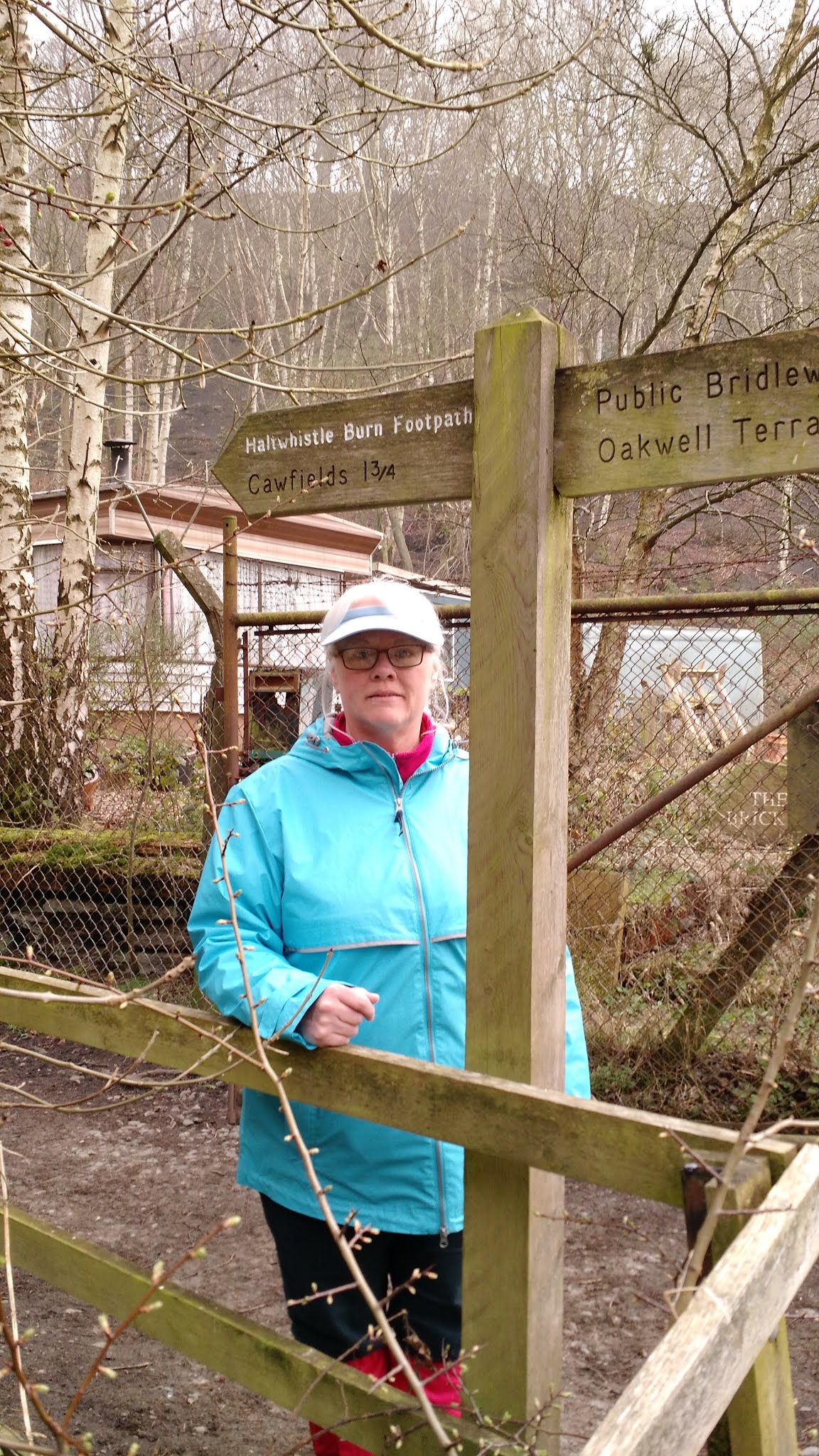 |
| Darla--at start of Haltwhistle Burn Footpath |
In retrospect, the rain gear (though it was misty when we set out) was not needed--not this trip. It should be noted, however, that the weather was a very, very different story when we returned in 2018 to take on Hadrian's Wall over the Winshield Crags to
Housesteads. Inclement would not come close to fully describing it. But I am ahead of myself.
For the 2017 excursion, gaiters were another story. Those who would venture forth from these United States would be well advised to bring a pair. They take little if any luggage space and weight. And should visitors take on these kinds of walks, gaiters are invaluable.
Indeed, the upper reaches of the Haltwhistle route below the Wall are soggy, if not a mire. This was especially true winding through the earthworks of three Roman camps near Moor Cottage just below the Wall.
 | ||
| 2017--Above Haltwhistle Burn just below the Roman Camps |
These camps had at various times in antiquity been built in approximately in the same location, in upper Haltwhistle Burn near springs (or "issues" as they are called locally).
Military camps were established along the length of the
Wall, typically just south of its remarkable Vallum. The
Vallum is impressive in its own right, and its scale is perhaps most pronounced in the flat farmlands by Thirlwall Castle and Greenhead, where Roman defenders could not so easily rely on the local geomophology of steep scarps and cliffs to assist them.
 |
| March 2017--upper Haltwhistle Burn mire near the Roman camps |
The Vallum was an enormous defensive ditch excavated behind Hadrian's Wall (i.e. on the friendly side of it), running parallel to the Wall and its supporting Roman military road. It was a "defense in depth". Should an attack from the "Picts" to the north breach the Wall, troops and cavalry could be assembled quickly behind the Vallum entrenchment, a fail safe of sorts.
In any case, we had resigned ourselves toward enduring what we assumed would be a damp and foggy day. It was north England in the month of March, after all. Our pessimism (at least in 2017) was greatly misplaced. As we approached the Wall, the fog lifted and revealed to us the magnificance of the Roman work.
 |
| 2017--approaching Hadrian's Wall near Walltown Crags as the mists lifted |
Our Good Lord provided us with an absolutely stunning early spring day along Hadrian's. We intersected the Wall near Mile Castle 42, when the curtain went up. And the warmth of the Sun was welcomed after mudding through the Roman camps below.
 |
| March 2017--Mile Castle 42, at Haltwhistle Burn Gap |
 |
| 2017--The Wall on at Hole Gap (Haltwhistle Burn) |
I mentioned above Roman "defense in depth". Even the awe-inpiring views of Hadrian's Wall are insufficient to fully appreciate the scale and reach of these defenses in Britannia, at the veritable edge of the Roman Empire. The masonry of the Wall, the enormous Vallum entrenchment and the supporting bivouac camps are only part of this depth.
Beyond the obvious strategic and cultural interest in Hadrian's Wall
construction, this "Marches" region of Cumbria and Northumberland bears a
familial interest, which brings me to a discussion about the origins of our family name--Whitley.
 |
| Terraced defensive walls--Whitley Castle. Cumbria |
Roughly, speaking, we are of Brigantes stock. This Celtic tribe was considered the most powerful in the British Isles. It certainly held the largest expanse of territory. Many today consider the Carvetii Celts (who were centered around modern day Carlisle) as a branch or possibly a sept of the Brigantes. The Selgovae Celts (centered north of the Wall in The Borders of Scotland near Melrose and Newstead) are also considered an adjunct clan of the Brigantes. Of linguistic note, the settlement of "Selkirk" (on Ettrick Water southwest of Melrose) is a reference to "Selgovae Church".
So, Hadrian's Wall essentially divided Brigantes territory--The Borders (on the Scottish side) and Cumbria and Northumberland (on the English side). That division was perhaps intentional--divided they fall, so to speak. Regardless, this general geographic region was where the Whitley family first hailed history. Of course this assumes a great deal, little of which can be known for certainty given the antiquity.
 |
| Roman terraced defenses--stone wall later agricultural work |
Compounding this obscurity is the fact that, beyond Roman troops and provincials, illiteracy prevailed among the subject Celtic people, including the Brigantes from whom the Whitley clan was reared. Generally speaking, the illiteracy of the ordinary "folk" precipitated what became known as the Dark Ages which followed Rome's abandonment of Britannia (c. 420 A.D.) This is something of a warning in regards to the state of our own educational system today.
In its heyday however, Rome's influence reached relatively deeply into Scotland (or Alba). A number of supporting forts and posts accompanied, or were associated "in depth" with Hadrian's Wall.
One such fort about 60 miles north of Hadrian's Wall, called Trimontium (a Latin reference to the three Eildon Hills) was in Selgovae territory near present day Melrose and Newstead on the River Tweed. Trimontium was actually the largest Roman installation in Scotland. And while it is normally assumed that Rome quickly abandoned everything south of the Antonine and fell back to Hadrian's Wall, apparently that did not apply to Trimontium. The River Tweed, in Celtic, takes the meaning of "border". That border would have been demarcated by Rome's Trimontium installation at Newsteads, which is considered to be the oldest continually inhabited settlement in Scotland.
Another such fort, this one to the south of Hadrian's Wall, was Epiacum in Cumbria...which is now called Whitley Castle. Epiacum is the Latinized British name of "Epiakon," which is probably the name of a local chieftain of the Brigantes. Epiacum was constructed in the territory of the Brigantes Celts, a tribe that was initially (albeit briefly) an allied client kingdom of Rome.
 |
| Epiacum (Whitley Castle) remains |
Epiacum was built
concurrent with Hardian's Wall, around 122 A.D.
on a main trunk Roman Road called "Maiden's Way". Its builders were the Sixth Roman Legion. So, Epiacum at its founding was part of the Hadrian in depth defenses. And Epiacum was very heavily fortified. In fact, it is claimed to have the most elaborate
surviving earthworks of any fort anywhere across the entire Roman Empire. This would indicate that at Epiacum (or Whitley Castle) extensive
and long term local hostility existed. Its defenses were improved or modified several times by Rome. And this would also indicate that Rome placed great importance upon keeping the operational and strategic purpose of the fort.
That purpose, it seems, was to protect the lead-mine trade routes near present day Alston (to which we walked after our visit to Whitley Castle). Lead was a strategic material; indeed, it still is. Typically, lead was cast for sling ammunition for Roman auxiliaries. Though we may dismiss them today in our chauvinism of modern time, slings were a critical military weapon, deadly in skilled hands of special units. It is said that the heavier sling shot (weighing about 2 ounces) could easily reach speeds of 100 m.p.h. If it struck its aim, it could take off the top of your head. It is said that a sling of lead shot could reach nearly a quarter mile if slung at a high trajectory. That is equivalent to the limit of an M-16 (at about 400 meters). Talk about a standoff ranged weapon for its day!
Roman lead sling shot artifacts are found at battle sites all over the Roman Empire, including Trimontium mentioned above. Smaller lead sling "bullets," weighing approximately one ounce, were something of a terror weapon. Small holes were drilled into them, so that when launched (or slung) they made whistling or buzzing noise, to the terror of "barbarians". These whistling lead shot were smaller than heavier slingshot, and thus could be slung at greater distances. Groups of 3 or 4 such lighter "whistling bullets" could also be launched from a single sling. Massed slings and their lead ammunition were a key, and perhaps indispensable component, of Roman battle tactics. So, the lead mine routes protected by Whitley Castle were vital to Britannia's defense.
 |
| 2017--Alston, Cumbria |
Below Epiacum's terraced "ramparts," deep defensive ditches were constructed in lower and wetter ground. It is possible, or perhaps likely, that these defenses were built to counter Celtic chariots. By the time "Whitley Castle" was constructed, Romans considered the use of chariots as antiquated. Nevertheless, Celts still used them with varying degrees of success.
 |
| 2017--possible defenses against chariot charges at Epiacum |
 |
| 2017--Foundation of one of Epiacum's walls |
 |
| 2017--View from top of Epiacum ruin toward Whitley Commons |

No comments:
Post a Comment