Labels

Tuesday, December 22, 2020

Gigha--A New Day

February 21, 2019--An Idaho "dusting" of snow
Our 2019 spring outing to Gigha began, as all our trips do, in our Idaho winter planning stage…it was an “if we can fit it in” excursion. 

The main 2019 goal (once enabled with a car rental), was to explore remote Kintyre and visit Knapdale’s Neolithic and Bronze Age archeological complex at Kilmartin.  It just so happened that a Gigha visit could fit…if we wedged it in on Sunday morning.   

Wedging a Gigha outing into Sunday, after spending all day Saturday, from flight to B&B, was possible because Kintyre Hire, the car rental shop, would not open until Monday.  Sunday we were afoot.  Normally, our first day on the ground in Scotland is a more sedate deal, as we reprogram the bio-clock for Greenwich Time.  To do Gigha, jet lag would have to wait. 

Saturday, April 13, 2019--Inverary 926 Bus Stop
Our international overnight landed late Saturday afternoon at Glasgow.  While not necessarily a flat out race to beat the clock, still, we had to be “determined” with our ground transportation.  Clearing airport customs, we jumped on the familiar “purple bus” (Airport Express) to Glasgow’s Buchannan Bus Station.  We did manage to trim about a half hour...barely enough to grab a quick bite from Gregg’s cafĂ© in Buchannan Station before boarding the only public transport from Glasgow to Campbeltown—the familiar 926 Bus.

The 926 (a regular route run several times a day) was the last bus to Campbeltown on Saturday evening.  It put us into Campbeltown, at the end of the line, about 10:15 p.m. Saturday night.  Graciously, our Earadale B&B hosts waited up for our arrival.  Gigha would happen in the morning, early. 


Sunday morning at Campbeltown
  

I do not want to give the impression that Gigha was an afterthought.  To the contrary, we wanted to visit—Gigha’s Ogham Stone, Kilchattan and of course its famous Achamore Gardens.  Darla does not pass up opportunities to explore U.K.'s gardens, which almost define Britain.  Gigha was penciled into the itinerary.

Sunday, April 14, 2019--Achamore Gardens, Gigha

Achamore Gardens would also add a small connective theme.  Its famed Rhododendron collection was the planting stock used to refurbish Brodick Castle Gardens on the Isle of Arran, which we would visit the following week. 

Achamore Gardens--Echium pininana?  In any case weird and invasive

Its 54-acres now overgrown, Achamore Gardens are being returned to order, mostly as a labor of love by resident gardeners on Gigha and volunteers across the U.K.  That said, there is a commercial angle.  Large public gardens in the U.K. are tourist attractions.  And Gigha seeks to attract.  There's tourist money in them thar' gardens.
April 14, 2019--Kilchattan, lancet window looking east to Kintyre

Achamore Gardens were laid down by Lieutenant-Colonel Sir James Nockells Horlick, 4th Baronet in 1945.  Peerage costing a pretty penny, it should be noted that the Horlick fortune was founded upon malted milk, as crazy as that may seem.  Horlicks malted milk business traded hands several times, following Sir Horlick’s death in 1972, until finally ending up (currently) in Unilever Corporation's hands.  (To scale it, note:  in late 2018, Horlick's Indian subsidiary traded for a cool $3.8 billion.) 

Credit:  Wisconsin Historical Society


The Achamore Mansion, however, was built earlier, by Lieutenant-Colonel Sir William James Scarlett in 1884.  The Isle of Gigha, its tenancies, businesses and in a practical sense its people, were sold
for £49,000 to Sir William's father in 1856 by Sir John Carstairs MacNeill (of Colonsay and the Clan MacNeill of Argyll).  At the time of the title transfer, Clan MacNeill had held Gigha, its ancestral home, for half a millennium from the Scottish Crown, with only brief interludes involving the quarrelsome Clan MacDonald.

Achamore House, Gigha

In their turn, the Scarletts sold the Gigha estate in 1919.  "Flippage" of Gigha's ownership traded hands many times in the 20th century, until it was acquired by Sir Horlick in 1944 who laid in the Achamore Gardens. Following Sir Horlick’s death in 1972, Gigha would again repeatedly flip in rapid succession.  

Unfortunately, the Gioghach (the people of Gigha) suffered under Scotland’s feu or feudal tenancy ownership.  Gigha’s population serves as a barometer of the health of the Gioghach under feudal tenancy.  In late 18th century, at the time of America's independence, Gigha supported over 600 people.  

The rapid “flippage” of ownership in the 20th century, however, nearly emptied Gigha to the point that by the year 2000 (one year before Gigha was eventually sold at market to the island’s inhabitants themselves) the island held only 95 people, with derelict housing. 

White Rhododendron at Achamore

Today, Gigha is no longer under feu.  It is in the hands of its people.  With various grants, and re-examining the purpose of capital, Gigha’s population decline has finally reversed, after several centuries, and is once again expanding.  Gigha optimistically represents a new day…one of “community capitalism” versus the last vestiges of aristocratic cronyism, which still plagues Scotland’s people in far too many ways.  But Gigha?...new businesses, including sustainable energy wind generators, new housing and new opportunities are remaking its future. 

March 28, 2018--croft ruins at Baliacrach, Mull

In stark contrast, our interest in visiting Gigha followed our 2018 visit to Isle of Mull’s Glengorm Estate, where we walked the ruins of Baliacrach croft and saw firsthand the inhumanity of
Fuadaichean nan GĂ idheal (the Highland Clearances).

Lastly, Gigha, first recorded in history in mid-500 A.D., was part of Dalriada—under the Lords of the Isles.  Gigha has long been known as a Hebridean island with rich agricultural land (approximately 900 acres arable).  Gigha was subjugated under the Viking realm around 800 A.D. until the Battle of Largs (1263 A.D. on Ayrshire's Firth of Clyde coast) ended Viking domination in Scotland.


April 25, 2019--North of Largs at Wymess Train Station 


Scots celebrate the battle at Largs as an independence, of sorts.  It did change the destiny of Scotland.  So too, then, may Gigha.  

Monday, December 14, 2020

Gigha--Another note on the weather

The Isle of Gigha, the most southerly of the Inner Hebrides, lies in the Sound of Jura only three miles off Kintyre Peninsula's western shore at Tayinloan.  Gigha, the subject of this travelogue, is an anecdotal example for discussing capitalism--community capitalism.

Ferry at Tayinloan on Kintyre; Gigha middle; Jura's Paps in background

First, the hamlet of Tayinloan on Kintyre.  Now simply a stop for the 926 Bus (Glasgow to Campbeltown), Tayinloan was something of a ghost town.  One soul with a chainsaw was cutting posts or firewood as we walked through.  Economically, Tayinloan is gone. 

April 14, 2019 Tayinloan--shops boarded up

Recent travel guides claim Tayinloan has a store, post office, coffee shop and pub.  It didn't.  So, caveat emptor.

Those heading to Gigha on a day trip might (logically) assume they can grab quick day trip supplies in Tayinloan at the bus stop before boarding the ferry.  Its commercial buildings are empty, closed and placarded with notices of sale.  

April 14, 2019--Tayinloan Bus Stop

Perhaps the only economic transaction taking place in Tayinloan is at its one older self serve gas pump.  To our surprise (we assumed the pump was not functional) while we waited to catch the 926 Bus back to Campbeltown after a gusty damp gray outing to Gigah, a car did pull down off the highway for self fuel at the pump.  We saw no visible card machine; the method of payment was a mystery.  No one was around.  The car pulled back up onto the A83, southbound toward Campbeltown.

April 14, 2019--Darla on Tayinloan Burn Bridge

Better times passed Tayinloan when the A83 highway was built  50 yards or so upstream, avoiding the narrow ancient stone bridge.  Tayinloan today is practically trampled under the highway viaduct.  Sad nostalgia perhaps, but the reality is that a rough single track road is insufficient to carry the commerce and travel necessary for modern times.

The walk from the Tayinloan bus stop is about 15 long minutes.  Just outside Tayinloan on the paved track to the Gigha ferry, a couple new construction bungalows were festooned with foreclosures.  Partly finished, but roofed, they stood open to the elements with sheeting shredding in the winds.  Difficult times in Kintyre.

April 15, 2019--Mull of Kintyre at St. Columba's Footprint; view west

Kintyre (called "Scotland's Mainland Island") is the geographic bar which defines the southerly boundary of Scotland's Inner Hebrides.  Waters east of Kintyre, to its leeward, are called the Firth of Clyde.  The Firth's isles--Arran, Bute and Cumbrae--are not considered part of the southern Inner Hebrides though they are much the same.  

If a distinction exists, it would be that waters in the Firth of Clyde are upwelling, or riverine, under the influence of Scotland's second largest river, River Clyde, along which fabled shipyards once built much of the world's ocean going fleets.  Difficult times on the Clyde as well. 

Gigha's "southerly latitude" allegedly fosters a warmer micro climate (relative to the Kintyre mainland).  For our part, at least on the Sunday we visited, Gigha's climate could in no way be misconstrued with warmth.  It was anything but that. 

April 14, 2019--MV Loch Ranza landing at Tayinloan "terminal"

A previous article [May 26, 2019 Celtic Cross, "Seize Quickly!"] addressed the North Atlantic's power, and its oft hard weather.  It bears repeating.  Weather in the Argyll islands on the windward edge of the the North Atlantic ought to inspire awe and a healthy dose of cautious preparation if one is out and about on foot, as we were.  Early spring can very much be a Dr. Jekyll and Mr. Hyde type deal.  That's an appropriate comparison, considering the famed Scottish author Robert Louis Stevenson penned the classic work in 1886.  He must have taken his example from Argyll's weather. 

In fairness, we have certainly had ample share of glorious and brilliant spring days in our Easter sojourns to Scotland.  The day we visited Gigha, however, we got Mr. Hyde. 

The best description of the driving damp wind (at least while in genteel company) was that it ached.  This made the 30 or so minute wait for the ferry seem interminable.  Tayinloan ramp is totally exposed to winds off the Jura Sound.  Those winds probably began somewhere near Florida, might have once been warm.  But by the time the North Atlantic beat all vestiges of warmth from them, they ended as ice somewhere up near Norway.

April 14, 2019--Tayinloan ferry jetty

It was an  excruciating wait, with few places to hide at the empty landing.  We tried huddling behind a partial glass phone booth at the top of the ramp, but were driven off.  We retreated behind the  block building which housed the public toilets.  Finally, we were mercifully spared by the arrival of the venerable MV Loch Ranza, a small "loch class" drive through vessel in the stable of CalMac (Caledonian MacBrayne).  For those who do not possess a yacht or a small aircraft, the CalMac ferry is the only way to get to Gigha.

April 14, 2019--MV Loch Ranza from Gigha; view east; Kintyre in background

The 20-minute sailing was over a fairly choppy tidal race in Jura Sound, which kicked up spay against the ferry windows.  But to be honest, we hardly noticed.  Our full attention was focused on trying to recover body temperature from the boiler heat of the passenger cabin.     

Should the adventurous travel to the Argyll at Easter, beyond good stout boots, a water and wind tight parka is an absolute necessity.  Without one, survival could be sketchy should weather turn.  And it does in early spring--several times a day even.


Saturday, November 28, 2020

Whitley Castle

During our 2017 Easter tour to the U.K., we hiked part of Hadrian's Wall (westward from Hole Gap at Haltwhistle Burn over the Walltown Crags).  This Roman construction is a World Heritage site that formerly was the approximate border between present day Scotland and England.  

Although we had our initial doubts, the early Spring weather in 2017 was absolutely glorious. 
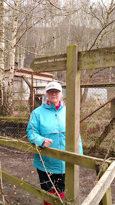
Darla--at start of Haltwhistle Burn Footpath
Our 2017 route to Hadrian's Wall took us up Haltwhistle Burn.  We suited up, donning rain gear and gaiters, expecting the inclement conditions of the infamous wet English weather.  

In retrospect, the rain gear (though it was misty when we set out) was not needed--not this trip.  It should be noted, however, that the weather was a very, very different story when we returned in 2018 to take on Hadrian's Wall over the Winshield Crags to Housesteads.  Inclement would not come close to fully describing it.  But I am ahead of myself. 

For the 2017 excursion, gaiters were another story.  Those who would venture forth from these United States would be well advised to bring a pair.  They take little if any luggage space and weight.  And should visitors take on these kinds of walks, gaiters are invaluable.

Indeed, the upper reaches of the Haltwhistle route below the Wall are soggy, if not a mire.  This was especially true winding through the earthworks of three Roman camps near Moor Cottage just below the Wall.  


2017--Above Haltwhistle Burn just below the Roman Camps

These camps had at various times in antiquity been built in approximately in the same location, in upper Haltwhistle Burn near springs (or "issues" as they are called locally). 

Military camps were established along the length of the Wall, typically just south of its remarkable Vallum.  The Vallum is impressive in its own right, and its scale is perhaps most pronounced in the flat farmlands by Thirlwall Castle and Greenhead, where Roman defenders could not so easily rely on the local geomophology of steep scarps and cliffs to assist them.  

March 2017--upper Haltwhistle Burn mire near the Roman camps

The Vallum was an enormous defensive ditch excavated behind Hadrian's Wall (i.e. on the friendly side of it), running parallel to the Wall and its supporting Roman military road.  It was a "defense in depth".  Should an attack from the "Picts" to the north breach the Wall, troops and cavalry could be assembled quickly behind the Vallum entrenchment, a fail safe of sorts.  

In any case, we had resigned ourselves toward enduring what we assumed would be a damp and foggy day.  It was north England in the month of March, after all.  Our pessimism (at least in 2017) was greatly misplaced.  As we approached the Wall, the fog lifted and revealed to us the magnificance of the Roman work.

2017--approaching Hadrian's Wall near Walltown Crags as the mists lifted

Our Good Lord provided us with an absolutely stunning early spring day along Hadrian's.  We intersected the Wall near Mile Castle 42, when the curtain went up.  And the warmth of the Sun was welcomed after mudding through the Roman camps below.

March 2017--Mile Castle 42, at Haltwhistle Burn Gap

2017--The Wall on at Hole Gap (Haltwhistle Burn)

I mentioned above Roman "defense in depth".  Even the awe-inpiring views of Hadrian's Wall are insufficient to fully appreciate the scale and reach of these defenses in Britannia, at the veritable edge of the Roman Empire.  The masonry of the Wall, the enormous Vallum entrenchment and the supporting bivouac camps are only part of this depth. 

Beyond the obvious strategic and cultural interest in Hadrian's  Wall construction, this "Marches" region of Cumbria and Northumberland bears a familial interest, which brings me to a discussion about the origins of our family name--Whitley. 

Terraced defensive walls--Whitley Castle. Cumbria


Roughly, speaking, we are of Brigantes stock.  This Celtic tribe was considered the most powerful in the British Isles.  It certainly held the largest expanse of territory.   Many today consider the Carvetii Celts (who were centered around modern day Carlisle) as a branch or possibly a sept of the Brigantes.  The Selgovae Celts (centered north of the Wall in The Borders of Scotland near Melrose and Newstead) are also considered an adjunct clan of the Brigantes.  Of linguistic note, the settlement of "Selkirk" (on Ettrick Water southwest of Melrose) is a reference to "Selgovae Church".

So, Hadrian's Wall essentially divided Brigantes territory--The Borders (on the Scottish side) and Cumbria and Northumberland (on the English side).  That division was perhaps intentional--divided they fall, so to speak.  Regardless, this general geographic region was where the Whitley family first hailed history.  Of course this assumes a great deal, little of which can be known for certainty given the antiquity.  

Roman terraced defenses--stone wall later agricultural work

Compounding this obscurity is the fact that, beyond Roman troops and provincials, illiteracy prevailed among the subject Celtic people, including the Brigantes from whom the Whitley clan was reared.  Generally speaking, the illiteracy of the ordinary "folk" precipitated what became known as the Dark Ages which followed Rome's abandonment of Britannia (c. 420 A.D.)  This is something of a warning in regards to the state of our own educational system today.

In its heyday however, Rome's influence reached relatively deeply into Scotland (or Alba).  A number of supporting forts and posts accompanied, or were associated "in depth" with Hadrian's Wall.  

One such fort about 60 miles north of Hadrian's Wall, called Trimontium (a Latin reference to the three Eildon Hills) was in Selgovae territory near present day Melrose and Newstead on the River Tweed.  Trimontium was actually the largest Roman installation in Scotland.  And while it is normally assumed that Rome quickly abandoned everything south of the Antonine and fell back to Hadrian's Wall, apparently that did not apply to Trimontium.  The River Tweed, in Celtic, takes the meaning of "border".  That border would have been demarcated by Rome's Trimontium installation at Newsteads, which is considered to be the oldest continually inhabited settlement in Scotland. 

Another such fort, this one to the south of Hadrian's Wall, was Epiacum in Cumbria...which is now called Whitley Castle.  Epiacum is the Latinized British name of "Epiakon," which is probably the name of a local chieftain of the Brigantes.  Epiacum was constructed in the territory of the Brigantes Celts, a tribe that was initially (albeit briefly) an allied client kingdom of Rome.


Epiacum (Whitley Castle) remains

Epiacum was built concurrent with Hardian's Wall, around 122 A.D. on a main trunk Roman Road called "Maiden's Way".  Its builders were the Sixth Roman Legion.  So, Epiacum at its founding was part of the Hadrian in depth defenses.  And Epiacum was very heavily fortified.  In fact, it is claimed to have the most elaborate surviving earthworks of any fort anywhere across the entire Roman Empire. This would indicate that at Epiacum (or Whitley Castle) extensive and long term local hostility existed.  Its defenses were improved or modified several times by Rome.  And this would also indicate that Rome placed great importance upon keeping the operational and strategic purpose of the fort.

That purpose, it seems, was to protect the lead-mine trade routes near present day Alston (to which we walked after our visit to Whitley Castle).  Lead was a strategic material; indeed, it still is.  Typically, lead was cast for sling ammunition for Roman auxiliaries.  Though we may dismiss them today in our chauvinism of modern time, slings were a critical military weapon, deadly in skilled hands of special units.  It is said that the heavier sling shot (weighing about 2 ounces) could easily reach speeds of 100 m.p.h.  If it struck its aim, it could take off the top of your head.  It is said that a sling of lead shot could reach nearly a quarter mile if slung at a high trajectory.  That is equivalent to the limit of an M-16 (at about 400 meters).  Talk about a standoff ranged weapon for its day!

Roman lead sling shot artifacts are found at battle sites all over the Roman Empire, including Trimontium mentioned above.  Smaller lead sling "bullets," weighing approximately one ounce, were something of a terror weapon.  Small holes were drilled into them, so that when launched (or slung) they made whistling or buzzing noise, to the terror of "barbarians".  These whistling lead shot were smaller than heavier slingshot, and thus could be slung at greater distances.  Groups of 3 or 4 such lighter "whistling bullets" could also be launched from a single sling.  Massed slings and their lead ammunition were a key, and perhaps indispensable component, of Roman battle tactics.  So, the lead mine routes protected by Whitley Castle were vital to Britannia's defense.


2017--Alston, Cumbria

Below Epiacum's terraced "ramparts," deep defensive ditches were constructed in lower and wetter ground.  It is possible, or perhaps likely, that these defenses were built to counter Celtic chariots.  By the time "Whitley Castle" was constructed, Romans considered the use of chariots as antiquated.  Nevertheless, Celts still used them with varying degrees of success. 

2017--possible defenses against chariot charges at Epiacum
 
 
2017--Foundation of one of Epiacum's walls

From the top of Whitley Castle, the vista takes in an area immediately outside the fortification.  Here,  round houses (a common indigenous dwelling in the U.K. at this time) may have been contemporary with the occupation of Epiacum.  Without archeological exploration, this is not yet knowable given these ordinary dwellings date at least back to the early Bronze Age.  Housing structures (their foundations at least) are gathered into a somewhat orderly town-like "plan," if that term applies, at Whitley Castle.  Apparently several thoroughfares existed.  Such settlements are more or less typical around Roman fortifications.  At Epiacum, local farmers, merchants and tradesmen would ply their living. 
 
In the upper left of the following photo, looking down Epiacum's gate ramp, a moorland hill can be seen beyond a stone wall (of recent construction).  This hill is called "Whitley Commons".  As such, it would have been used by local inhabitants for common grazing of their livestock, likely by sheep.  If Whitley Commons was indeed managed as a commons by the local inhabitants, most likely that would have occurred later, during Anglo-Saxon times at some point after Roman abandonment.  
 
2017--View from top of Epiacum ruin toward Whitley Commons

When Rome did finally abdicate Britannia, leaving her to her fate (roughly in 420 A.D.), the Roman garrison at Epiacum apparently was absorbed by local Brythonic peoples.  This might have been done in league with the last remaining Roman troops at Epicum.  By 420 A.D. troops in Britannia (at least those not already stripped out of the Province) had ceased to be paid their wages by Rome.  The abandoned small Roman contingent at Epiacum (likely Nervii, a Belgaic tribe with a reputation as warriors) had few options beyond staying and settling among the local Celtic population, if they could. 
 
The last photo is an image of the sign board at Whitley Castle.  It shows a reconstruction of the Roman fort.  A subsequent blog post will further detail this "family" castle of ours...         
 

Thursday, November 26, 2020

Variant Spelling--A Ribbing of Mr. Copeland

Walking is quintessentially a U.K. thing. This post will be about "mining" travel information for a possible hike excursion in an already crowded itinerary, as will be the case when we return to the U.K. once COVID-19 has lost its grip on the news cycle. 

On occasion, while searching the internet for potential places to visit or walk, I come across rather distinctive stuff, to the point of filing it in the "Neat--Possible Visit" folder. Less often, I find things that could also immediately be "weaponized" (filed under the "Snide" folder) in the ongoing good nature game of one up-manship--or trading "ribbings" as it might be called by those stalwart souls who may consider themselves fortunate to warrant the term: "friends of mine". 

Turning the pun at the absolute most precise opportunity is, well, something of an art form. And when "Neat" conjuncts with "Snide" that's in the zone of astrological alignments. This brings me to my friend Mr. Copeland of Texas, the same being confused as to which side of "The Borders" he was derived.  That said, he remains unapologetic in his favor of the English. For his benefit then, I discovered just such an alignment in a news item relating to the rediscovered ancient Medieval bridge over River Teviot, the oldest bridge in Scotland by the way. A fascinating history indeed. 

Before poking poor Mr. Copeland, I should first acknowledge the volunteer group (Heritage Paths) who work to conserve and promote historical paths throughout the U.K.—whether market paths or old Roman roads, and all ancient routes of travel in between. These guys do phenomenal preservation service. Would that more in Idaho did the same. 

Ruins of the actual Medieval timber bridge over River Teviot were rediscovered near Ancrum, just below Jedfoot (which I take to be the ford on River Teviot). The Heritage Paths group helped field surveys and document research. This bridge was part of the most important road (the King’s Highway) between Scotland and England. It remained vitally important well beyond the Medieval age. Mary Queen of Scots is said to have used this bridge traveling southward to seek sanctuary from her “suth’n” cousin, Queen Elizabeth I. (Although in hindsight, Mary probably greatly regretted having crossed that bridge to visit.) 

Oak timbers from the Medieval bridge are now being conserved. They’ve been dated by C-14 and are being used for dendroclimatology—to add to climate data from the Medieval times. As I understand it, the medieval Bridge was set just upstream of the ford in order to maintain “all-season” travel between the two nations during seasonal floods. River Teviot otherwise is a barrier. Below is a 1913 map with the Heritage Path superimposed.

Anyhow, this Roman road heritage path passes just east, near “Copland,” a variant spelling of Copeland. And here is where I find my dirk, so to speak. 

The Roman Road shown in the 1913 map is a lengthy northern extension to what is known as Watling Street (on the 1913 map). Romans probably used the Teviot ford (rather than build a bridge). Whether they also armored the ford with a stone bed is unknown. Watling Street spanned Roman Britain. It began with several freight spokes radiating into a hub near Dover. The road then moved inland to London, and ended at Viroconium Cornoviorum, a Legion stronghold now called Wroxeter. Wroxeter grew near the junction of territories held by the Ordovices and Cornovii Celtic tribes. (Cornovii being part of its Latin name.) In its day, Wroxeter was the fourth largest city in Roman Britain.

The road extension built by Romans headed northward, roughly to Jedburgh and Ancrum on the River Teviot (where the Medieval bridge was rediscovered). The northern extension was a long distance military road to “The Borders”…in other words, sort of like the Eisenhower Interstate program. It was designed to move men and materiel quickly to the Borders when under threat.
While historically, as the 1913 map indicates, this road too has been called Watling, today it is more typically called Dere Street to distinguish it.

As for Mr. Copeland, I should note that the Battle of Ancrum in 1545 (during the last years of Henry VIII) occurred in the heights above this Medieval bridge over River Teviot. The Scots won, putting a temporary halt to his English pirates who (as usual) pillaged northward into Scotland. The English hired German and Spanish mercenaries to do their dirty work, and appended these foreign mercenaries to groups of Borderers; the word treasonous comes to mind. In any case, this mercenary force could pretend to be Scots fighting Scots...plausible deniability that might be called. The raiders burned down houses in the region, with women and children still inside. 

At Ancrum on Castle Hill, however, Scottish Pikes prevailed. True to form, once the tide of the fight was obvious, the treasonous Scottish Borderers tore off their red crosses (insignia indicating their allegiance to the wife abuser and serial murderer Henry VIII of England). They then pretended themselves to be loyal Scots…as if. Shortly thereafter, Henry VIII died; which was none too soon.  Speaking to the savagery of the battle, a monument at Ancrum is said to exist above the ancient bridge to commemorate Lilliard, a Scottish lass who fought at Ancrum to avenge the killing of her laddie. She had her legs cut off, and still fought on, on stumps until she died. 

Roughly, Ancrum was "first" recorded in 1136 A.D. when Kind David I of Scotland established a monastic settlement there. The larger nearby settlement of Jedburgh is older, with its church founded in the 800s A.D. by Ecgred, Bishop of Lindisfarne.  However, much earlier, Romans under Emperor Agricola (40 to 93 A.D.) built a “fortlet” at Chappuck just east of Jedburgh where Dere Street (the Roman road) crossed Oxnam Water. This fortlet was built easily within a living memory of Christ. 

Indeed, well before that, a pre-Roman site has been briefly defined, with the Romans building on top of it. A paucity of archeological work exists on the pre-Roman culture in the area. Taken together, this immediate area at the ford (bridge) over River Teviot has long been recognized as having strategic and economic importance. Although Ancrum today only has ~400 population; Jedburgh has ~4,000. 

We are considering a future trip to Scotland's Lowlands, and perhaps again to North England. If so, we may take part of the Heritage Path to the River Teviot.  With its newly rediscovered Medieval bridge, the battle site at Ancrum and the kirk ruins, that makes for an interesting hike. Besides, while walking it, we can always look for where the Copelands may have hidden their red cross insignias when, in panic, they tore them from their shirts.  I suppose they may wish for them to be returned? 

Here's the link: https://www.scottishconstructionnow.com/article/and-finally-lost-medieval-bridge-discovered-beneath-river-teviot

Wednesday, November 4, 2020

Darla took some time off the first week of July.  I call it time off rather than a vacation because ultimately most of it was invested into work here at our place...harvesting cutting Swiss chard, washing, blanching and it and then putting it away in food containers for the freezer.  Ditto spinach.  Lettuce and mixed greens were cut and put into fresh table salads.  Beet pickles were canned.  And so it went.  Weeding, watering, washing.

But, we did set time away to get up to Bonners Ferry, June 30th, to visit her family plot in the cemetery there.  A delayed Memorial Day or an early July 4th as it were.  From Bonners, we made a quick trip on US2 over to Libby, her city of birth.

The trip was not a poke in the eye of the isolation//quarantine guys.  Actually, we hardly came close enough to anyone to even think about needing to socially distance.  At the gas pumps in Bonners--one other guy an island over.  At Lolo--the same. 

We did stop at Kootenai Falls and the Swinging Bridge.  Now there, to be honest, a fairly large number of tourists from all over the country were stopped and checking out the falls.   But, given the fresh air, we figured no harm no foul. 


Kootenai Falls, MT June 30, 2020

                                        Kootenai Falls, MT June 30, 2020 


                                        Idaho's State Flower--syringa


                                                  Darla trying to work a photo